Everest 2017: Weather Watch
-
 Alan Arnette
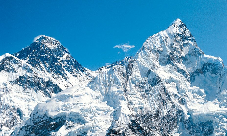

Sherpas are already at Everest Base Camp on the Nepal side establishing camps. The Icefall Doctors have also arrived and will start building the route thru the Khumbu Icefall soon. But the big question is what kind of mountain conditions and weather will be in store for the 2017 season?
This is perhaps more critical than in any recent season. As I have been suggesting, both sides of Everest could see record crowds for a number of reason I outlined in this post. I am expecting over 600 summits from the South (Nepal) side and well over 200 from the North (Tibet) totaling 800 from both sides, smashing the record set in 2013 with 658 total summits from both sides. In 2016, 641 climbers made the summit from both sides.
If we see summit days within the normal range of 6 to 16 (average of 11 since 2001) with low winds (under 30 mph) and reasonable temperatures (higher than -20F) then there should be limited issues with crowds. But if we have a repeat of only a few summit days similar to 2012 with only 4, the climbers are in for a very difficult season.
Also the conditions will be key for Ueli Steck who is aiming to traverse from Everest to Lhotse without supplemental oxygen. This will require excellent conditions even for a climber as strong and skilled as Steck. Another interesting climb to watch that will need excellent conditions is that of Korean Sung-Taek Hong on Lhotse’s South Face.
We already have two data points: Alex Txikon (Everest) and Bill Burke (Burke Khang) who both recently reported high winds, deep snow and extreme cold.
On Everest only a couple of weeks ago, Alex Txikon noted winds well over 40 mph at Camp 2 with air temp of -40F. He knew the winds would be higher and the windchill would have been deadly so he called an end to their expedition.
Bill Burke attempted a 22,775’/6,942m peak named after him, Burke Khang, only last week but called off his attempt due to poor conditions. As he left in a helicopter, the air temperature near the summit of his peak was -90C/-130F. I asked Everest weather expert Michael Fagin what the weather was like during that period:
The jet stream would continue to be over Burke-Khang over the next 10 days. With base camp winds of 45 mph and summit winds would be at least 55 mph at times with stronger gust. Although I’m expecting light snow over the next 10 days there was large amounts of snowfall that occurred in the March 9 to March 11 period and some models suggested of 20”+ of snowfall then.
Burke posted on 21 March:
… report applied to conditions at 18,000 feet, which was the elevation of our Base Camp and here is a summary of the forecast. Adding a multiplier for higher altitudes, this was truly devastating news. Plowing through waist-high snow in extremely vertical 75 plus degree terrain at high altitude is one thing. Doing so facing winds exceeding 75 mph in subzero wind-chill temperatures would be an act of suicide. With the full concurrence of Dawa and Naga, I called off the assault. The trip was over.
Russell Brice of Himex recently told me:
I see that the monsoon has already started to form so I will not be surprised if we have warm general temperatures on the mountain again this year. I personally feel that the freezing level is getting higher (in altitude) every year, hence we are seeing some radical changes in snow pack and ice formations. Something that we as mountaineers around the world need to be aware of and take note that routes are changing and so our decision making also needs to take note of this.
With these reports and observations, can we predict what the climbers will experience this year, or even in April? I asked two mountain weather experts, Chris Tomer of Tomer Weather Solutions and Michael Fagin of Everest Weather to look into their crystal balls for the next few weeks and take a stab at what the season might hold. Both professionals offer custom forecasts for climbers around the world.
Chris Tomer: Gradual Shift to More Typical Conditions
Alex Txikon ran into an expanding Madden Julian Oscillation (MJO) in the Indian Ocean during late February and early March. The residual effects were on-going throughout his expedition. MJO is a tropical anomaly that goes above and beyond existing forecasts. Think of it as another layer you stack on normal weather for Everest. The bottom line, it changed the weather on Everest to colder and snowier.
From my analysis, average temps were running 4 degrees Celsius colder than normal and precipitation was above normal. That pattern is gradually coming to an end. The MJO is retreating and more normal weather will resume on Everest starting next week. But, winds remain strong there this weekend and temps remain colder than normal. For example, summit winds on Saturday will touch 100mph with a jet streak and summit air temps are hovering around minus -40c.
Looking further ahead, the MJO retreats and high pressure remains firmly anchored over India through mid April. That translates into very typical weather on Everest.
And Michael Fagin: A Bit Breezy but Dry
Short-term forecast for Friday March 24 to Thursday March 30. This is a general forecast (non-summit) for Mount Everest area. Also note that winds forecasted for 18,000 feet (5454 meters) is at the general level of Everest base camp which is somewhat sheltered. Thus wind speeds listed would be experienced for areas that are not in wind sheltered such as some of the training peaks that are climbed.
Summary:
Winds: Forecast models showing a ribbon of 50 mph wind (80 km/hr.) that meanders at times near Everest over the period. Winds for 18,000 feet (5454 meters) vary greatly. Some models show winds 30 mph (48 km/hr.) at times and perhaps a few stronger gust for Saturday March 25 and for Thursday March 30.
However the US GFS model shows winds more in the 10 to 20 mph range (16 to 32 km./hr.) over this period. Please note these winds are much lower than what we saw in the period of March 10 through March 25 when a strong jet stream was over the Everest region for much of the time
Precipitation: With a drier west to northwest flow for much of the period, while we will have some clouds at times, just expecting lighter precipitation over this period. Also not seeing the formation of any major storms in Bay of Bengal.
Extended Outlook: March 31 to April 7
Over this period models tend to change often so hard to have a high degree of confidence. The exact timing of when the core of the jet stream returns is difficult to pinpoint however the trend over this period is for an increase in winds as the jet stream slowly migrates over our region again.
So I would think by April 6 to April 7 the jet would be over the region with strong summit winds and some strong winds at 18,000 feet at times. Finally not seeing anything to indicate a major precipitation event over this period. Also not seeing the formation of any major storms in Bay of Bengal.
Extended Thoughts for May
Most forecast models for this period in extended generally have very low level of confidence and many times one needs to look at if there is El Nino (above normal sea surface temperatures) or La Nina (below normal sea surface temperatures.)
El Nino being above normal temperatures off the equator portion off the South American Coast and La Nina below normal.
For much of this winter we have had a La Nina. “Normally” when there is a La Nina Asia gets above normal precipitation during the monsoon period that begins June 1. http://www.tropmet.res.in/~kolli/MOL/Monsoon/Historical/air.html
So if this is a normal pattern for La Nina we should have above normal precipitation. However I have not seen data that discusses if this means we have an earlier start to the monsoon season.
Also of note there are many other ocean patterns that impact our region and interact with the La Nina or El Nino patterns. Thus this is a very complicated pattern http://indianexpress.com/article/explained/monsoon-rain-drought-india-la-nina-el-nino-3062098/
I have seen some studies that indicate that during La Nina patterns we tend to get more and stronger cyclones that form in the Bay of Bengal but that is more for the late fall period.
Finally most forecast are showing a return to El Nino conditions later this year. We will see if this has the “normal” impact of below rainfall for the 2018 monsoon.
OK, there you have it, it appears that climbers can take a short breath of air with a decent forecast to get them to base camp. Beyond that, we will see.
alanarnette.com


Feedback